Delores Anticline
Highlights
- Road accessible — 64 km northeast of Monticello
- <5 km from power grid
- 68 km from the White Mesa Uranium Mill in Blanding
- Drill permit in progress
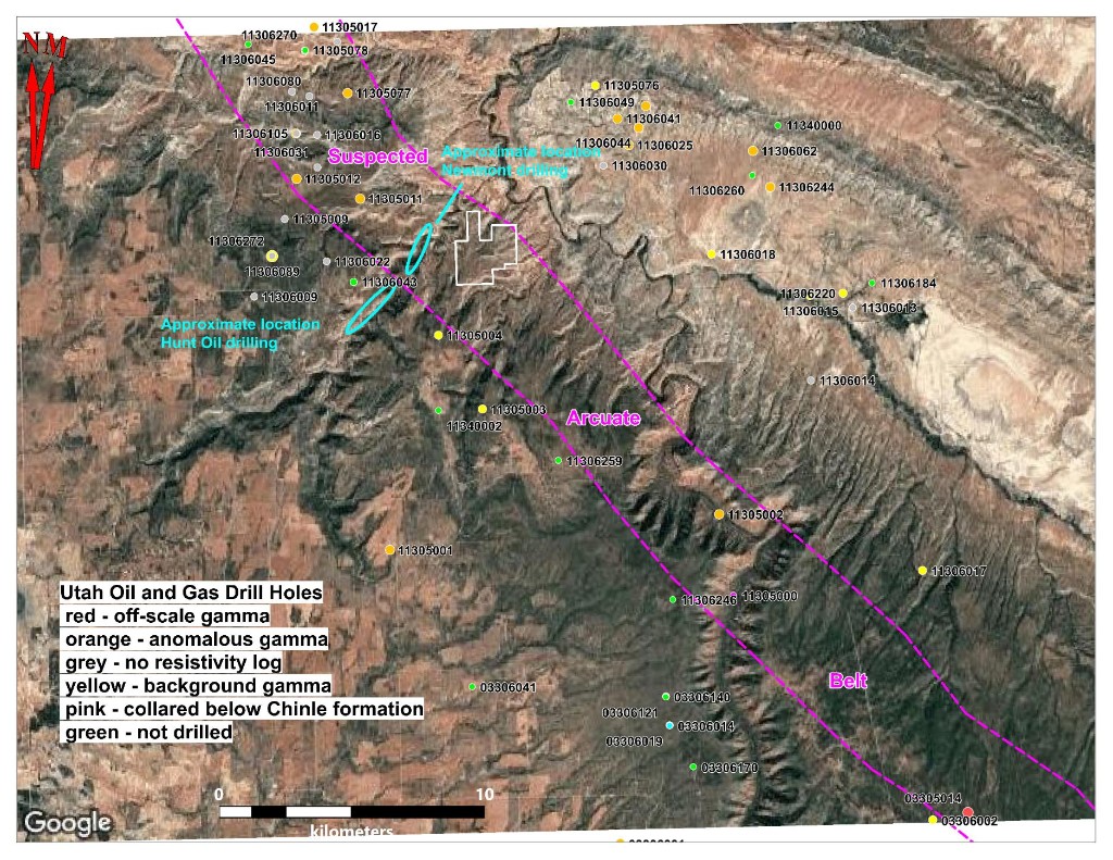
- 20 widely spaced oil and gas drill holes define a suspected arcuate belt some 50 km in length
- Mapping by USGS geologists located uranium mineralization in the Moss Back Member in Dolores Canyon
- Drilling in the 1960s by Hunt Oil and Newmont Mining encountered anomalous Geiger counts in the Moss Back Member
Overview
Atomic Minerals staked the Dolores claim block in 2022 targeting both the Chinle Formation and the Morrison Formation at the southern end of the Uravan Mineral Belt. The Uravan Mineral Belt produced 75.5M lbs. of U₃O₈ and 331.8M lbs. of V₂O₅ from 1,200 mines in the Salt Wash Member of the Jurassic Morrison Formation between 1947 and 1979.
The project is road accessible, located 64 km northeast of Monticello, within 5 km of the power grid, and 68 km from the White Mesa Uranium Mill in Blanding. A drill permit is currently in progress.
Historical Exploration
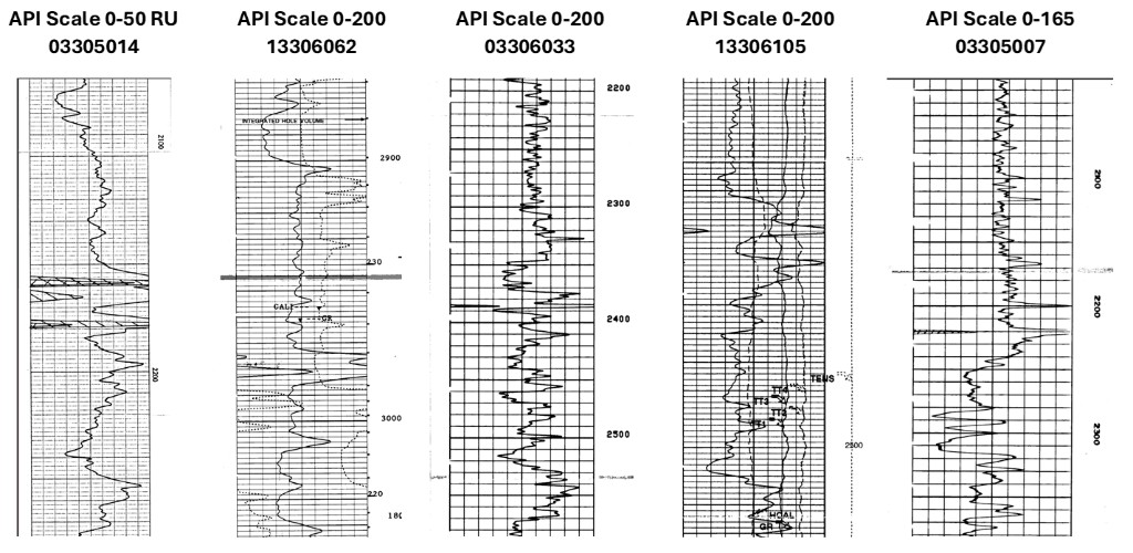
USGS geologists mapped uranium mineralization in the Moss Back Member of the Chinle Formation within Dolores Canyon. In the 1960s, Hunt Oil and Newmont Mining drilled in the area and encountered anomalous Geiger counts in the Moss Back Member, providing early confirmation of uranium potential along this belt.
20 widely spaced historic oil and gas drill holes have been reviewed, defining a suspected arcuate belt approximately 50 km in length. Anomalous gamma readings detected in the Chinle Formation across multiple holes form the foundation of the current exploration model.
Exploration Plans
Atomic Minerals has completed a thorough review of historical drilling data and is preparing to commence the permitting process. Plans for exploratory drilling are guided by historical data indicating potential uranium mineralization in the Moss Back Member of the Chinle Formation.