10 Mile
Highlights
- Road accessible — 30 km northwest of Moab, 4 km from the power grid, and 130 km from the White Mesa Uranium Mill in Blanding
- 7 Mile / 10 Mile area historically produced +1.7 million lbs U₃O₈ at an average grade of 0.26% from thicknesses of 0.3 to 2.4 m (1 to 8 ft)
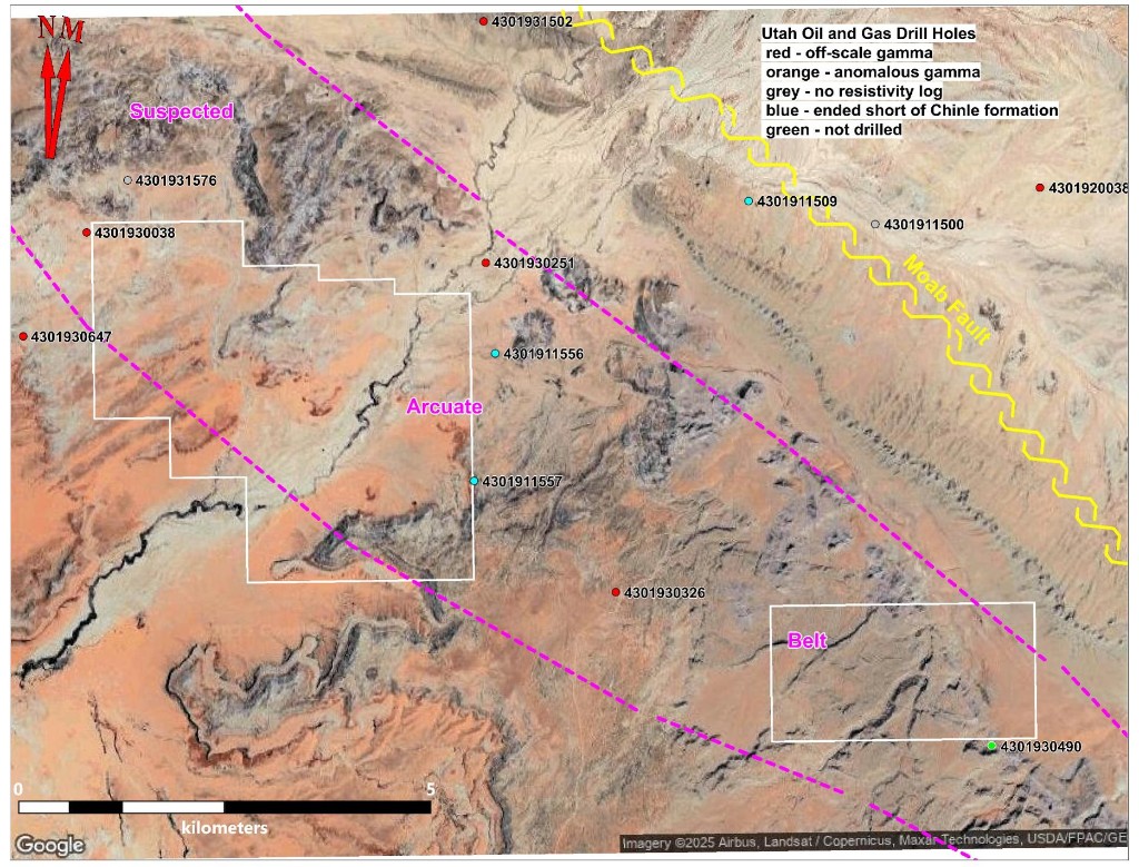
- 6 widely spaced drill holes define a suspected 15 km arcuate belt along the west side of the 10 Mile anticline
- East side of the anticline has been faulted and dropped ~1,500 feet
- Gamma ray anomalies identified in both the lower Chinle Formation and the shallower Morrison Formation
Overview
The 10 Mile anticline was first identified in 1972. In 2022, Atomic Minerals staked 5,020 acres in two claim blocks at 10 Mile. Located 30 km northwest of Moab, 4 km from the power grid, and 130 km from the White Mesa Uranium Mill in Blanding, the project is road accessible and well-positioned logistically.
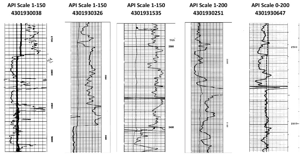
Six widely spaced historic oil and gas drill holes revealed gamma ray anomalies within the lower Chinle Formation, outlining a suspected 15-kilometer arcuate belt along the west side of the anticline. On the east side, the Moab Fault has faulted and dropped the Chinle Formation by approximately 1,500 feet. Uniquely at 10 Mile, a significant number of gamma ray anomalies were also identified in the shallower Morrison Formation.
Historical Drilling
The 7 Mile / 10 Mile area has a history of uranium production, with +1.7 million lbs U₃O₈ recovered at an average grade of 0.26% from mineralized thicknesses ranging from 0.3 to 2.4 m (1 to 8 ft). A review of Utah oil and gas gamma ray logs identified radiation anomalies across multiple historic drill holes within the Chinle and Morrison Formations.
Exploration Plans
The permitting process has been initiated for the 10 Mile Anticline Project, where historical oil and gas drilling has indicated potential uranium mineralization. The plan includes conducting exploratory drilling to further assess the uranium potential.