Harts Point
Overview
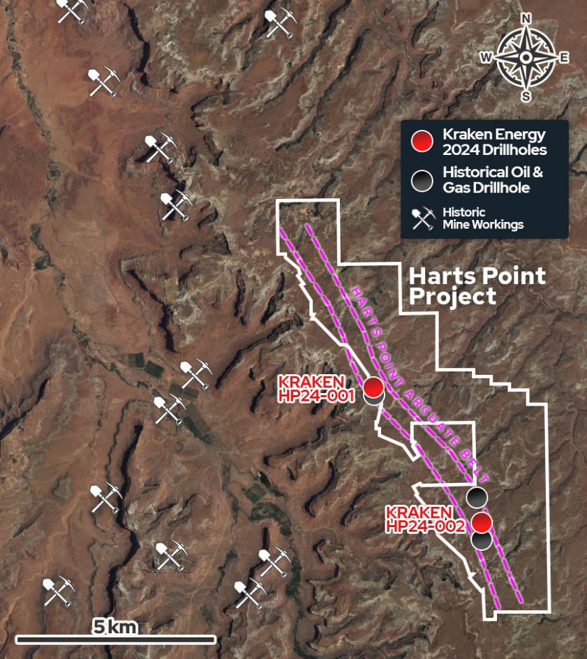
The Harts Point Project consists of 324 claims and covers the flank of the Harts Point anticline, approximately 40 miles by road west of Energy Fuels Inc.'s White Mesa Mill uranium processing facility. Three historic oil and gas holes drilled approximately 2.8 miles apart all located gamma ray log anomalies within the basal portion of the Chinle Formation.
Downhole Gamma Probe Results:
- Drillhole HP24-001 intersected a total of 12.9 m (42.3 ft) of elevated radioactivity with downhole probe readings from 252 counts per second ("cps") up to 653 cps from 151.5 to 421.5 m (497.0 to 1,382.8 ft)
- Drillhole HP24-001 Including 270 to 653 cps over 1.0 m (3.2 ft) from 415.1 to 416.1 m (1,361.9 to 1,365.1 ft)
- Drillhole HP24-002 intersected a total of 16.2 m (53.1 ft) of elevated radioactivity with downhole probe readings from 252 cps up to 2,162 cps from 107.8 to 390.4 m (353.6 to 1,280.7 ft)
- Drillhole HP24-002 Including 263 to 2,162 cps over 2.4 m (7.9 ft) from (1,261.2 to 1,269.1 ft)
* Background gamma readings through non-elevated zones typically range from 10-150 cps on the borehole gamma probe
Exploration Plans
Atomic Minerals is advancing the drill permitting process for the 6,500-acre Harts Point Uranium Project. The Bureau of Land Management has received the permit application and is currently reviewing it. The proposed exploration program plans to drill fifteen sites targeting uranium mineralization within the basal Moss Back Member of the Chinle Formation.